 puzzlerzone

Worldle
worldle.teuteuf.fr
Guess the country by its shape on the world map.
Countries, maps, flags and places from around the world.
83 indexed
Topic is what a puzzle is about. Choose a subject to narrow the directory, or view all puzzles at once.
Guess the country by its shape on the world map.
Pin the world locations on the map based on satellite images.

Guess the city given a satellite image, zooming out after each guess.

Guess the mystery country, given how close it is to each guessed country.

Guess the mystery country in as few guesses as possible, watch the map for hints after each guess.

Fill in the grid with flags that meet the criteria of both the row and column corresponding to their cell.

Guess the country by its flag.

Make groups of 4 flags that share something unique with the Flag of the Day.

Guess the country based on the chart.

Guess the direction and distance from the starting capital to the target capital.
Guess the country by its partially-drawn border, up to 50% drawn.

Guess how the region voted given a Google Streetview location. 5 rounds every day.
Guess how the neighborhood voted in the U.S. 2024 presidential election based on how it appears on Google Streetview
Guess which country the given city is in.

Guess the country from a five-vertex outline, with each wrong guess adding detail.

A daily world-map game where you pin a country for each clue and score by rarity.

A daily 3D-globe guessing game where stadium clues and legendary moments test your sports geography.

Pin the places behind famous people's stories in this free daily geography quiz.

A daily geography guessing game where snack packet clues lead you to the country of origin.
A daily geography puzzle where you chain countries by land borders from one endpoint to another.

Daily world-map city hunt: guess a city, gain a clue, and close in on the secret destination.

A daily five-round geography stat duel where you choose which of two countries leads the world.

A daily elevation guessing game where you place real places on a height gauge to score points.

Sketch a country's border from memory and see how closely your drawing matches the real map.

Daily Berlin U-Bahn logic puzzle: fill a 3x3 grid so every station matches its row and column clues.

Identify today's mystery US chain from a map of every location in six guesses.

Name real places, score by obscurity.
A six-mode daily geography puzzle that tests country identification through flags, shapes, rankings, and clues.

A quick daily web puzzle that pits seven US states against real statistics across four comparison modes.

A daily geography game where one guest's video story holds the clues to the country they represent.
Pick the more populous U.S. place in timed Census-based matchups and chase your best streak.

Daily five-round geography challenge: place a pin where each animal lives on a blank world map.

A quick daily flag quiz that asks you to separate genuine documented flags from invented lookalikes.

A blank globe, one reference country, and five rounds of pure geography instinct.

Resize silhouettes of countries, states, lakes, cities, and wonders to match a known reference object.
A daily country guessing game that gives you eight tries and clues about distance, region, flags, and more.

A daily geography challenge where you pinpoint the location and date of historical events on a 3D globe.

Daily satellite-view population guessing game with higher/lower clues and a 90% accuracy goal.

Daily geography challenge: pinpoint seven locations on a hexagonal world map, with zoom-based scoring for precision.

A daily military-profile deduction game where you identify a hidden country by comparing defense data.

Guess the daily hidden country in 7 tries using attribute and alphabetical color clues.

A daily geography puzzle where you build flags from parts with Wordle-style feedback.

Guess the US State in which the photo was taken.

Guess the Country/Region in which the photo was taken.

Five points are scattered across the world map, guess the countries they are located in.

Guess where and when the given movie scene was filmed.

Guess the year and location of the given photo.
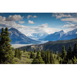
Guess the country based on the view.
Narrow down a location on the world map.

Connect the starting country to the ending country by naming countries in between them.
Guess where the travel photo was taken, 4 rounds every day.
Guess the right time and location of each historical photo.

Guess the US State by its outline on the map.

Guess the sea of the day in as few attempts as possible.
Guess the city based on the satellite image.
Guess the country based on its passport.

Guess the country by its exports.

Guess the top 5 countries that export the most of the given product.
Form groups of four exported products that are associated with one of the given countries.
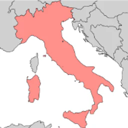
Guess the countries that border the highlighted country on the map.